
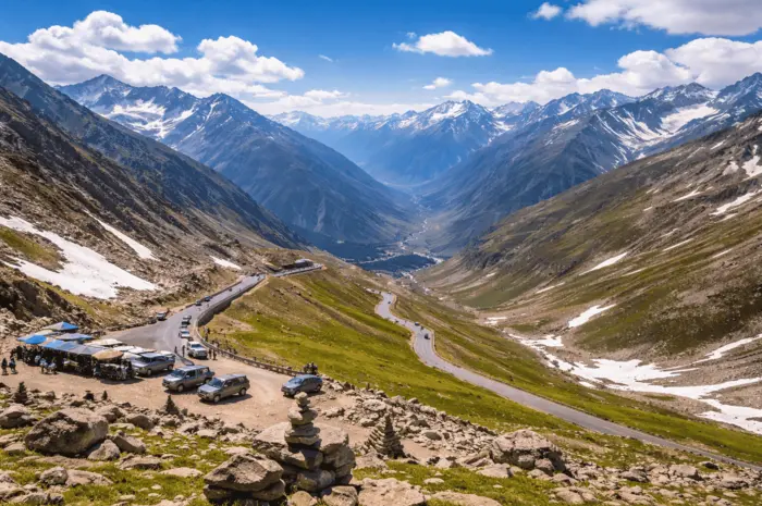
Standing at Babusar Top feels different. The air turns sharp, the road drops away behind you, and the horizon opens up in every direction. You are not just looking at mountains. You are above them.
Here’s the thing. Most guides tell you where it is. This one tells you how to experience it properly and avoid the mistakes people keep making.
What is Babusar Top?
Babusar Top is the highest point of the Kaghan Valley at 4,173 metres. It connects Naran in Khyber Pakhtunkhwa with Chilas in Gilgit-Baltistan through the N-15 road.
It is one of the few high mountain passes in Pakistan that you can reach without trekking.
Where is Babusar Top Located?
Let’s break it down in simple terms.
Babusar Top sits on the road between Naran and Chilas. If you are travelling from Islamabad, it comes after Naran and before you enter Gilgit-Baltistan.
Distance snapshot:
- Naran to Babusar Top: Around 70 km
- Chilas to Babusar Top: Around 60 km
- Islamabad to Babusar Top: Around 300 km
What this really means is that Babusar Top is the gateway. Cross it, and you move from Kaghan Valley into the northern regions.
Why is Babusar Top Famous?
People don’t come here for one thing. It is a mix of everything working together.
- Wide mountain views that stretch for miles
- A high-altitude drive that feels raw and exposed
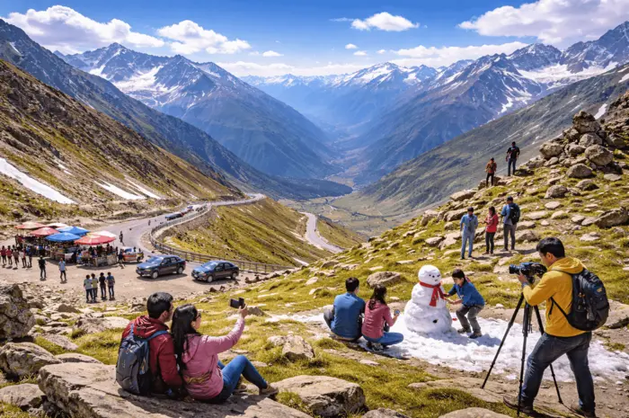
- Snow patches that remain even in early summer
- A direct route into Gilgit-Baltistan
Most places give you scenery. Babusar gives you scale.
Best Time to Visit Babusar Top
Timing matters here more than most places in Pakistan.
Babusar Top stays open from May to September. Outside this window, heavy snow blocks the road completely.
Month-by-month clarity
- May to June: Snow walls on both sides, colder, quieter
- July to August: Easiest travel, green landscapes, more crowds
- Early September: Clear views, fewer people, ideal balance
If you want fewer crowds and better light for photos, go in early September. It is the sweet spot.
Babusar Top Weather Conditions
Even in peak summer, it feels cold.
- Temperature: usually between 5°C and 15°C
- Strong winds throughout the day
- Weather can shift quickly from clear skies to fog
What this really means is simple. Dress warmer than you think you need to.
How to Reach Babusar Top
Route from Islamabad
Islamabad → Mansehra → Balakot → Naran → Babusar Top → Chilas
Travel time ranges between 8 to 10 hours, depending on stops and road conditions.
Distance Overview
| Location | Distance |
| Naran | ~70 km |
| Chilas | ~60 km |
| Islamabad | ~300 km |
The road is fully paved during the open season, which makes it accessible for most vehicles.
Road Conditions and Driving Guide
The road is smooth, but that does not mean it is easy.
You are dealing with steep climbs, sharp turns, and sudden drops.
What to watch out for
- Narrow sections with no guard rails
- Fog that reduces visibility within minutes
- Long downhill stretches that stress brakes
Practical driving tips
- Start early and cross during daylight
- Check your brakes before leaving Naran
- Avoid driving in rain or heavy fog
- Keep fuel topped up before Naran
Most issues happen because people underestimate the road. Don’t.
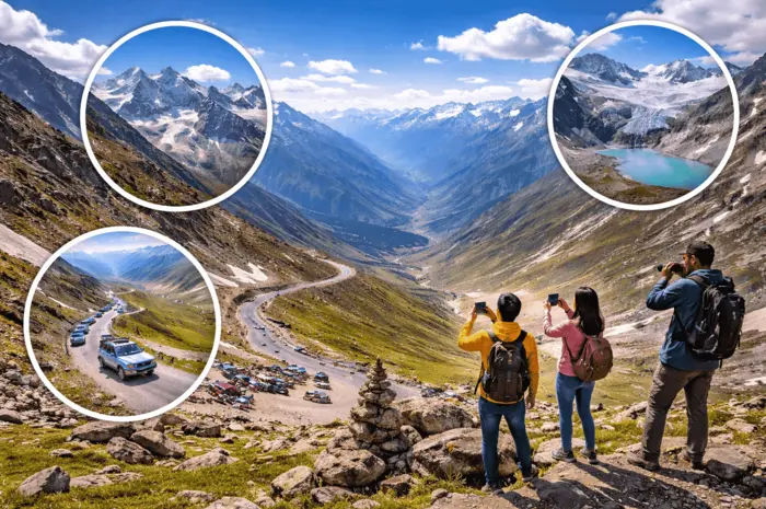
Things to Do at Babusar Top
You won’t find structured activities here. That is the point.
- Stand at the viewpoint and take in the full valley
- Walk around the top for different angles
- Take photos during early morning or late afternoon
- Experience the stillness that comes with altitude
Give yourself time. Rushing through defeats the purpose.
Places to Visit Near Babusar Top
The route itself is part of the experience.
Lulusar Lake
A large, still lake surrounded by mountains. Ideal for a stop before the climb.
Batakundi
A quiet village with greenery and rivers.
Jalkhad and Besal
Key stops on the way up. Good for short breaks.
Dudipatsar Lake
For those willing to trek. Remote and untouched.
Travel Tips for Babusar Top
Let’s keep this practical.
- Carry warm clothes even in July
- Bring snacks and water
- Fill your fuel tank at Naran
- Expect weak or no mobile signals
- Keep basic medicine for altitude discomfort
What this really means is that you need to be self-sufficient once you leave Naran.
Is Babusar Top Safe?
Yes, during the open season it is generally safe for tourists.
The risks come from:
- Sudden weather changes
- Steep and winding roads
Stick to daytime travel and check conditions before you go. That alone reduces most of the risk.
Babusar Top Height and Key Facts
- Elevation: 4,173 metres
- Road: N-15
- Region: Kaghan Valley
- Connects: Khyber Pakhtunkhwa to Gilgit-Baltistan
It is one of the highest paved roads in Pakistan that you can drive without special equipment.
Babusar Top vs Khunjerab Pass
People often compare the two. Here’s a clear breakdown.
| Feature | Babusar Top | Khunjerab Pass |
| Height | 4,173 m | 4,693 m |
| Access | Seasonal | Mostly open |
| Experience | Scenic drive | Border crossing |
| Location feel | Valley pass | High-altitude plateau |
If you want raw scenery and a dramatic drive, Babusar stands out. If you want altitude and a border experience, Khunjerab wins.
Sample Itinerary
1-Day Trip (From Naran)
- Start early from Naran
- Reach Babusar Top in 2 to 3 hours
- Spend time at the top
- Return before sunset
3-Day Trip (From Islamabad)
Day 1: Islamabad to Naran
Day 2: Naran to Babusar Top to Chilas
Day 3: Return or continue towards Gilgit
This gives you enough time without rushing.
Final Thoughts: Is Babusar Top Worth It?
Yes, and not just for the views.
It is one of those drives where the road itself becomes the highlight. You climb steadily, the air gets thinner, and then suddenly, everything opens up.
If you plan it right, go at the right time, and give yourself space to take it in, Babusar Top delivers an experience that stays with you long after the trip ends.
Be part of Caledonian Travel, share your travel experiences, and help others explore with clarity and confidence.
FAQs About Babusar Top
It usually opens between May and September. In winter, the road is closed due to snow.
It stands at about 4,173 metres above sea level.
The distance is around 70 kilometres.
Yes, standard cars can reach it during the open season on the N-15 road.
It can be risky in poor weather or low visibility. Daytime travel reduces most risks.
No, but your car should be in good condition, especially the brakes.
Usually in May or early June, depending on snow clearance.
Yes, you can still see snow in May and June along the roadside.